All Map Projections Have This In Common
Muz Play
Apr 05, 2025 · 5 min read
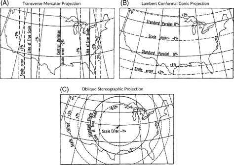
Table of Contents
All Map Projections Have This in Common: The Inevitable Distortion
The world is a sphere (or more accurately, an oblate spheroid). Trying to represent that three-dimensional shape on a flat, two-dimensional surface is inherently problematic. This is the fundamental challenge cartographers have wrestled with for centuries. While numerous map projections exist, each designed to minimize specific types of distortion, they all share one unavoidable truth: they all distort the Earth's surface in some way. This unavoidable distortion is the common thread uniting all map projections. Understanding this core principle is crucial for interpreting maps accurately and avoiding misinterpretations.
The Impossibility of Perfect Representation
The act of projecting a sphere onto a plane is mathematically impossible without introducing some form of distortion. Think of trying to flatten an orange peel – you'll inevitably stretch, compress, or tear it. Similarly, transferring the Earth's curved surface onto a flat map requires compromises. This inescapable distortion manifests in several ways, primarily affecting:
1. Shape (Conformality)
Conformal projections strive to preserve the shapes of small areas. Angles are maintained, meaning that a small circle on the Earth will appear as a circle on the map (though its size may be distorted). However, even conformal projections distort the scale, meaning the relative sizes of landmasses will not be perfectly accurate. Examples include the Mercator projection, often used for navigation but infamous for its exaggeration of landmasses near the poles.
2. Area (Equivalence)
Equal-area projections prioritize accurate representation of the relative sizes of landmasses. The area of a region on the map is proportional to its area on the Earth. However, these projections typically distort shapes, often making landmasses appear stretched or squeezed. Examples include the Gall-Peters projection, which accurately depicts areas but significantly distorts shapes, particularly near the poles.
3. Distance
No projection can perfectly preserve distances across the entire map. Some projections might maintain accurate distances along specific lines (like the standard lines in cylindrical projections), but distances measured elsewhere will be inaccurate. This is especially pronounced in projections that significantly distort shapes or areas.
4. Direction
While some projections strive to maintain accurate directions from a central point, true direction preservation across the entire map is generally impossible. The distortion of angles inherently impacts the accuracy of direction.
Understanding the Types of Distortion
The different types of distortion are not independent; they are interconnected. A projection that minimizes one type of distortion will inevitably increase another. This trade-off forms the basis of the choice of projection for a particular map. The cartographer must carefully consider the purpose of the map and select a projection that minimizes the most critical distortions for that application.
For instance:
- Navigational charts often prioritize conformal projections (like the Mercator) to accurately represent angles and directions for sailing or flying. The area distortion is a less critical concern in this context.
- Thematic maps showing population distribution or resource allocation often prioritize equal-area projections (like the Gall-Peters) to accurately represent the relative sizes of regions. Shape distortion is less crucial in such applications.
- World maps intended for general purposes face a tougher challenge. They must make compromises, often sacrificing perfect accuracy in all aspects to create a reasonably balanced representation.
The Influence of Projection Choice on Interpretation
The selection of a map projection is not merely a technical decision; it has profound implications for the interpretation of the map's information. Different projections can dramatically alter the perceived relationships between geographic features, leading to skewed understandings of size, shape, distance, and direction. This is why it is crucial to be aware of the projection used and to consider its inherent limitations.
For example:
- The Mercator projection's exaggeration of high-latitude regions has historically led to a skewed perception of the relative size of countries like Greenland and Russia compared to countries near the equator.
- Equal-area projections, while accurately representing areas, can distort shapes significantly, making it difficult to assess the actual shapes of continents.
Beyond the Single Projection: The Need for Multiple Perspectives
Recognizing the limitations of individual projections underscores the importance of using multiple maps to gain a comprehensive understanding of the Earth's geography. Instead of relying on a single projection to convey all information, it's often beneficial to consult maps using different projections to appreciate the various perspectives they offer. This multifaceted approach minimizes the risk of misinterpretations stemming from the inherent distortions of any single projection.
The Future of Map Projections: Technology and Innovation
While the fundamental problem of representing a sphere on a plane remains, technology and innovation continue to refine the art of cartography. Software and algorithms are increasingly sophisticated in handling the complexities of map projections, enabling the creation of dynamic and interactive maps that allow users to explore different projections and their respective distortions.
Moreover, the rise of 3D mapping and virtual globes offers alternative ways to visualize the Earth, circumventing the limitations of traditional flat maps to a certain extent. These tools allow for more intuitive exploration of geographic data without the inherent distortion associated with traditional map projections. However, even these technologies still face challenges in accurately representing the Earth’s complexity on a screen or display.
Conclusion: Embracing the Inherent Limitations
All map projections share a common characteristic: they inevitably distort the Earth's surface. This inherent distortion is not a flaw but a fundamental consequence of attempting to represent a three-dimensional object on a two-dimensional surface. By understanding the types of distortion, the compromises involved in choosing a projection, and the impact of projection choices on interpretation, we can approach map reading with a critical and informed perspective. This awareness allows us to use maps effectively while acknowledging their inherent limitations and appreciating the ingenuity and artistry behind the craft of cartography. The challenge for cartographers lies not in eliminating distortion entirely—an impossible feat—but in selecting and utilizing projections that best serve the map's purpose and minimize distortions critical to its intended use and audience. The responsible use of maps necessitates an understanding of their limitations and a commitment to viewing the world through multiple cartographic lenses.
Latest Posts
Latest Posts
-
Where Do The Light Independent Reactions Take Place
Apr 05, 2025
-
Place The Steps Of Eukaryotic Dna Replication In Order
Apr 05, 2025
-
What Is An Experimental Unit In Statistics
Apr 05, 2025
-
How To Draw A Water Molecule
Apr 05, 2025
-
How Do Natural Disasters Contribute To Genetic Drift
Apr 05, 2025
Related Post
Thank you for visiting our website which covers about All Map Projections Have This In Common . We hope the information provided has been useful to you. Feel free to contact us if you have any questions or need further assistance. See you next time and don't miss to bookmark.
