Difference Between Reference And Thematic Maps
Muz Play
Mar 20, 2025 · 5 min read
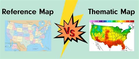
Table of Contents
Delving into the Differences: Reference Maps vs. Thematic Maps
Maps are fundamental tools for understanding our world, providing visual representations of geographical information. However, not all maps are created equal. Two broad categories dominate cartography: reference maps and thematic maps. While both display geographical data, their purpose, design, and the information they convey differ significantly. This article delves into the core distinctions between these map types, exploring their characteristics, applications, and the nuances that set them apart.
Defining Reference Maps: A Foundation of Geographic Information
Reference maps, also known as general-purpose maps, serve as a foundation for spatial understanding. Their primary objective is to show the location and relationships of geographic features. Think of them as a detailed snapshot of a particular area, providing a framework for further geographic analysis. Accuracy and completeness are paramount in reference map creation.
Key Characteristics of Reference Maps:
- Comprehensive Geographic Detail: Reference maps strive for completeness, including a wide array of features like roads, rivers, coastlines, boundaries, cities, and landmarks. The level of detail varies depending on the map's scale; a large-scale map will show more detail than a small-scale map.
- Emphasis on Location: The primary function is to pinpoint the precise location of geographic features. Accurate positioning and representation are crucial.
- Neutral Presentation: Reference maps avoid subjective interpretations or biased representations. They aim to present information objectively.
- Multiple Features: They showcase a variety of geographic features without prioritizing any single element. The focus is on a holistic view of the area.
- Scale and Projection: Reference maps prominently display the scale, indicating the ratio between map distance and real-world distance. The map projection (method of representing the 3D Earth on a 2D surface) is also crucial and is chosen to minimize distortion.
- Examples: Topographic maps, road maps, atlases, and Google Maps are prime examples of reference maps. These maps prioritize displaying the location and relationships between various geographic features.
Understanding Thematic Maps: Communicating Spatial Patterns
Thematic maps, in contrast to reference maps, go beyond simply showing locations. Their purpose is to communicate specific geographic patterns or distributions. They highlight a particular theme or variable, such as population density, climate, or election results, displaying this information spatially. Effective thematic map design relies on choosing the appropriate visualization techniques to best illustrate the chosen theme.
Key Characteristics of Thematic Maps:
- Focus on a Specific Theme: Thematic maps center on a single theme or variable. This theme dictates the map's design and visual representation.
- Data Visualization: Thematic maps use a variety of techniques to represent data visually, including choropleth maps (using color shading), dot maps (using dots to represent data points), isopleth maps (using contour lines), and cartograms (distorting the shape of geographic areas to represent data).
- Data-Driven Design: The map's design is entirely driven by the data being visualized. Color schemes, symbols, and other visual elements are chosen to effectively communicate the patterns in the data.
- Interpretation and Analysis: Thematic maps are designed to facilitate interpretation and analysis of geographic patterns. They often include a legend and potentially additional data tables or charts for better understanding.
- Examples: A map showing population density using color shading (choropleth map), a map illustrating rainfall patterns using isohyets (lines connecting points of equal rainfall), and a map displaying election results using different colors for different parties are all examples of thematic maps.
Comparing and Contrasting: Key Differences Highlighted
The following table summarizes the key differences between reference and thematic maps:
| Feature | Reference Map | Thematic Map |
|---|---|---|
| Primary Purpose | Show location and relationships of features | Communicate spatial patterns of a specific theme |
| Emphasis | Location and spatial relationships | Data visualization and spatial patterns |
| Data | Geographic features (roads, rivers, etc.) | Specific variable (population, temperature, etc.) |
| Design | Objective and neutral | Data-driven and visually expressive |
| Visualization | Primarily lines, points, and polygons | Diverse methods (choropleth, dot, isopleth, etc.) |
| Interpretation | Direct observation of features | Requires interpretation of visual representations |
Choosing the Right Map: Applications and Suitability
The choice between a reference map and a thematic map depends entirely on the intended purpose.
When to Use a Reference Map:
- Navigation and Location: When needing to find a specific location or navigate to a destination.
- Geographic Overview: When wanting a general overview of an area's geographic features.
- Base Map for other Analyses: As a foundation for overlaying thematic data or conducting spatial analysis.
- Situational Awareness: Understanding the context and layout of the terrain or infrastructure.
When to Use a Thematic Map:
- Spatial Data Visualization: To visually communicate patterns or distributions of a specific variable.
- Data Analysis and Interpretation: To facilitate analysis and interpretation of spatial data.
- Highlighting Geographic Trends: To illustrate trends, anomalies, or relationships within the data.
- Communication and Education: Effectively communicating complex spatial data to a wider audience.
- Decision Making: Informing decisions related to resource allocation, urban planning, or environmental management.
Advanced Considerations: Hybrid Maps and Map Evolution
The distinction between reference and thematic maps isn't always absolute. Many maps blend elements of both categories, creating hybrid maps. For example, a road map might include color-coded elevation data (a thematic element) within the context of road networks (a reference element).
Furthermore, the evolution of digital mapping technology has blurred these lines even further. Interactive online maps often seamlessly integrate reference and thematic layers, allowing users to toggle between different data views and customize their map experience. This dynamic approach enhances both geographic exploration and data analysis.
Conclusion: Mastering the Art of Map Selection
Understanding the fundamental differences between reference and thematic maps is critical for anyone working with geographic information. Choosing the appropriate map type directly impacts the effectiveness of communication and the quality of spatial analysis. By mastering the characteristics, strengths, and applications of each type, you can leverage the power of cartography to unlock deeper insights into our world and effectively communicate complex geographical information. From navigation to advanced spatial analysis, selecting the right map forms the cornerstone of successful geographic exploration and data interpretation. This in-depth understanding allows for more informed decision-making, enhanced communication, and a deeper appreciation of the power of cartography in conveying geographical insights.
Latest Posts
Latest Posts
-
Do Protists Have A Cell Wall
Mar 20, 2025
-
All Matter Can Be Classified As
Mar 20, 2025
-
Measurement Of The Amount Of Matter In An Object
Mar 20, 2025
-
Significant Figures Addition And Subtraction Practice
Mar 20, 2025
-
How To Calculate Ph At The Equivalence Point
Mar 20, 2025
Related Post
Thank you for visiting our website which covers about Difference Between Reference And Thematic Maps . We hope the information provided has been useful to you. Feel free to contact us if you have any questions or need further assistance. See you next time and don't miss to bookmark.
